

Exandas GIS app for iPhone and iPad
Developer: 3pi Information Systems
First release : 03 Jan 2018
App size: 1005 Kb
Exandas- Gis is a Web-based Telematics fleet management application which has been designed in order to achieve the highest functionality and speed for managing the vehicles of each customer, as well as adapting itself to other commercial programs (ERP – CRM). Examples of services include (but aren’t limited to): information for fuel supply, productive operation times of the vehicle, supervision of fixed timetables as well as fuel loss alarms and speeding.
Link Technologies provides its services via a Microsoft Incubation Centre. This partnership results in high reliability (SLA 99%) as well seamless connectivity and information exchange with other commercial software programs.
Training videos of the application and all its modules are included. The videos are constantly updated in order to include all the new application’s new and improved features.
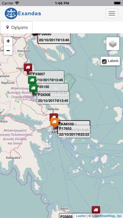
EXANDAS – Gis uses Google maps as a mapping system. Our company, which, exploits all the capabilities of Google maps; furthermore, we provide pan-European (including Turkey) geographical coverage and routing.
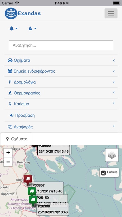
Exandas – Gis provides:
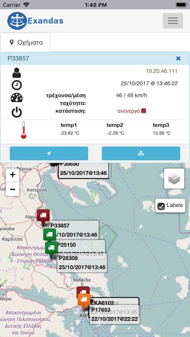
Real Time Vehicle Monitoring
Vehicles’ Trajectory and Stops Reports
Clientele Importation
SMS Alarm
Vehicles’ Stops and Trajectory Projection on Google Maps
Additionally to the basic application, we provide add-on modules which cover a number of needs for your company’s fleet management.
Fuel Management
Routing
Temperatures Management and Printouts
Instant Access to Client
Connection with Navigator